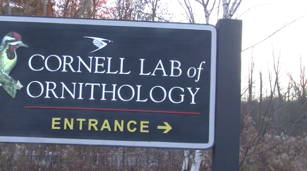
YardMap is a program that was developed through the Cornell Lab of Ornithology that gives bird enthusiasts the ability record bird populations in their area on an interactive social site.
“Citizen scientists have the chance to make a difference,” YardMap project assistant Robyn Bailey said. “Every piece of information that a person submits is like putting together the pieces to a big puzzle that we as scientists can look at in aggregation that gives us stories and lessons that we can learn from.”
With this new program, users can help create an environmentally friendly habitat for birds in rural, urban, and suburban areas.
Users are able to create a map of their favorite birding destinations using the Google Map interface. They then recreate the area online to show ecological details or any additions added, including bird feeders or newly added native plants, in addition to the bird populations they log.
According to the YardMap website, over 75% of threatened or endangered species live on private land. Through this program, project managers hope to promote habitat conservation by teaching users, who become citizen scientists, the keys to protecting a birding area along how to site the negative impacts on a habitat. This should also be higher up. But we still need a news peg.
YardMap was started in 2006 at Cornell after years of the program fielding spontaneous calls and emails from people excited about birds on their property and their personal efforts to support that habitat, says YardMap project leader, Dr. Rhiannon L. Crane said.
“It became obvious that there was a demand for a place where people could share their stories, but also a rich data source for us to learn more about how people could make a difference for birds,” she said.
The project began with the theme of “my yard counts” in efforts to start making a difference yard-by-yard. In 2009, the National Science Foundation caught wind of the project and approved an application to fund the program, Bailey said.
“Through YardMap, participants make real changes in their backyards and communities to support wildlife, while simultaneously contributing to scientific understanding of land use across the nation,” said Ellen McCallie, a program director at the National Science Foundation who helped approve the funding of YardMap. “It’s the YardMap applications and social networking platform that connect publics, scientists, and data that allows this to happen,” she said. “NSF is excited to fund this work because it contributes to science, people learning science, and being able to do science almost anywhere at any time.”
With this support, YardMap was able to launch a public beta version in March 2011.
Since then, over 5,747 maps have been drawn through the program. A majority of the maps are of areas in New York State; only 72 of the users are from the Ithaca area. According to the YardMap website, this program has gained national recognition with maps of Virginia, New York City and Wisconsin.
[swfobject]2422[/swfobject]
The White House’s Champions of Change recognized one notable YardMap user this summer. Former military cultural analyst Mike Cohn, gained national recognition through his YardMap at Centerville Business Park in Virginia along with his other citizen science work.
“I wanted to do a little more than just going birding and taking photographs,” Cohn said. “They became vehicles for me to enjoy my own interests.”
While Cohn does enjoy birding and supporting a healthy bird habitat in his area, Cohn has pushed his bird conservation work further to create a project called Soldiers2Scientists. This program, motivated by Cohn’s own experiences transitioning back into civilian life after a year in Afghanistan, would use citizen science programs like YardMap to support an easier transition for soldiers returning home as a type of therapeutic recreation Cohn said.
“A soldier protecting the homeland abroad, it is not much of a jump to come home and protect the homeland natural resources while you are here.”
“People are using the app in ways we didn’t anticipate,” Bailey said. “Other scientists are taking the app into their own hands and use it for their own research questions.”
YardMap is preparing to release a new version of the program on Monday that will give users the opportunity to be more social through the site. It will allow users the ability to see the habitat efforts on neighboring maps in order to promote collaboration on conservation in local communities.
Supporting bird habitats is conducive to environmentally friendly communities in both rural and urban areas, said Maggie Jaicomo, a naturalist at the Eagle Creek discovery Ornithology center in Indianapolis, IN.
“Birds are a great keychain tool in communities, by having birds in your backyard or in your neighborhood, you connect people to nature in an easy way,” Jaicomo said.
YardMap hopes to inspire entire communities to promote bird-friendly habitats locally and to steward those communities of birds as well, Bailey said.
“[Yards] are not all about bird feeders and pretty trees. Everything has a habitat and we as homeowners, renters or even college students can manipulate that habitat in a way that is better for wildlife,” Bailey said. “The more people that use it, the faster it is going to grow and I don’t see it slowing down at all.”